History of Our Clay
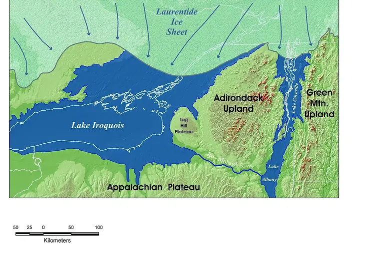
Around 12,500 years ago our location was under the water of a glacial Lake Ontario called Lake Iroquois.
-
Its waters were held back by the massive glacier that blocked the St. Lawrence River.
-
At its peak, Lake Iroquois was three times the size of modern Lake Ontario, with water levels 30 meters (100 feet) higher than today’s levels.
-
The north shore of the lake reached 50 km beyond today’s shoreline.
-
Over a period of about 800 years, season by season, fine particles of clay would wash into the lake and settle to the bottom, creating a lacustrine clay bed as deep as 10 metres (33 feet) in some places.
-
Around 11,700 years ago, the glacier hade retreated north and Lake Ontario had dropped lower than today's level. The brackish water of the Champlain Sea flooded the lake basin to create the Gilbert Gulf. We were once again under water for several hundred years.